Four Views of Bingham Canyon in 1909
These pictures were provided by David Lang. He is a great-grandson of Col. Enos Andrew Wall.
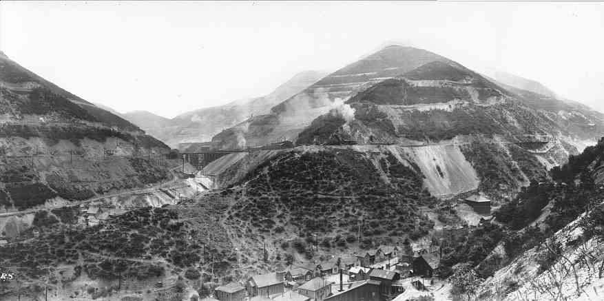
This view is looking southward up Main Bingham Canyon from the north side of Carr Fork junction. The Utah Copper mine is about half a mile away. Today the copper mine has swallowed up everything in sight, and even those intimately familiar with today's topography have difficulty comprehending how much material has been moved, or seeing any landmark that is common both to old photographs and today's scenery.
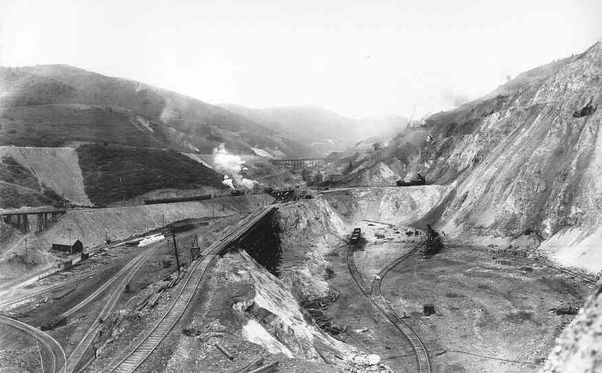
Here is Utah Copper's very first drop cut. Ore was loaded by the steam shovel to the right of the tracks and hauled out through a tunnel, roughly below the camera station.
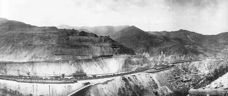
We are looking westward at the hillside above the drop cut, from a position several hundred feet up the hill. Much of the mining activity involved relocating unwanted waste rock to uncover ore. The Utah Copper mine relied heavily on rail traffic, and when the Denver & Rio Grande Railway was unable to live up to its commitment to carry the ore to the mill 30 miles away, additional stock was issued and Utah Copper built its own railroad, the Bingham and Garfield. For reference, Markham Peak is the notched peak at the right.
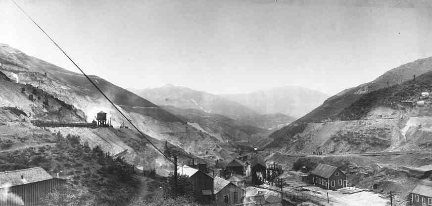
This view looks northward down main Bingham Canyon toward Markham Peak. This view down the canyon would have been familiar to all members of the Hickman family working their way down from Galena Gulch, the mouth of which is about another half-mile behind this viewpoint. Mining activity eventually made it impossible for traffic to get up the canyon to Copperfield, so in the mid-1930s a tunnel was built for automobile traffic. Copperfield was finally abandoned in the 1950s and the last residents moved out of Bingham Canyon in the early 1970s.
To visit the Hickman Map Room, click here.
To see additional pictures of Bingham in Mark Evans' collection, click here.
The Shipler photo collection has many pictures of Bingham; click here.
To return to the Hickman Museum Index page, click here.