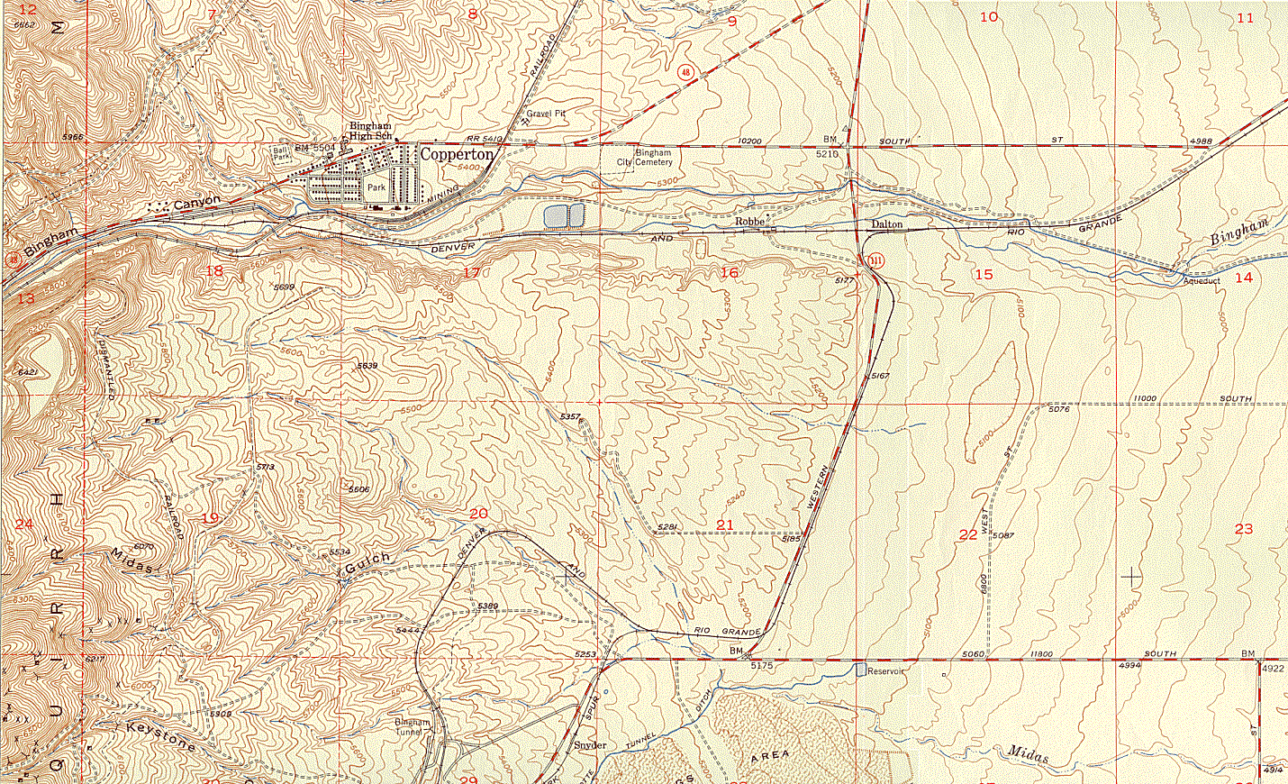
Hickman-Butcher Ranch Properties, Bingham Creek, Utah
 The Hickman Ranch, later transferred by Bill apparently as a wedding gift to his daughter, Sarah Catherine and her husband Samuel, is believed to have been located in about the middle of Section 16, just south of the word "Robbe". For a more detailed view of this area in 3D, click here. The Cotton family lived about half a mile to the west; their log home was located on an 1874 map, which can be seen by clicking here. The United States was originally surveyed using a Township and Range grid; each township is divided into 36 Sections; each of these is about a mile on each side. Smaller blocks of land are divided into quarters and quarter-quarters. Early survey methods were not very precise, so that's the best they could do at that time, and it provided a way in which large blocks of land could be described, sold and then taxed. Maps contain an awful lot of data, so the map should take some time to load. This is a segment of the Lark Quadrangle, published by the United States Geological Survey in 1952. There are more recent versions of this map (to see them--or maps of anywhere else--click here), but later mining developments and recent environmental cleanups have altered the terrain, and this map comes the closest to showing the area as it was when the Hickmans, Butchers and Cottons lived there. Mines and mills in Bingham Canyon have since polluted the soil so much that very little grows there today. Even after learning that they now belong to someone else, if you would like to learn more about these family ranch properties, click here. If you'd like to see Hickman-Butcher placer mining claims in Lower Bingham Canyon, click here. If you'd like to see a map of family lode claims in Upper Bingham Canyon, click here. If you want to return to the Index, click here.
